
West Highland Way Index.
Day 1 – Milngavie to Balmaha, 19½miles.
Day 2 – Balmaha to Inverarnan, 21½miles.
Day 3 – Inveranan to Bridge of Orchy, 19½miles.
Day 4 – Bridge of Orchy to Kinlochleven, 21miles.
Day 5 – Kinlochleven to Fort William, 14miles.
******
The West Haggis Way.
Day 1 – Milngavie to Balmaha, 19½miles.
After a long and not particularly restful night on the Cally Sleeper up from Euston, I wish I’d bothered to read some of my chosen guide-book – rather than just looking at the map. The guide I’d chosen was the HMSO Official Guide for the walk which I’d picked up on eBay for a couple of quid. The 1996 edition but it was still fine, and comes with the necessary 1:50000 OS sheets which is handy. Also handy within the first few pages of the guide are instructions on how to pronounce “Milngavie”, the start of the walk. Having not seen this it had to be explained to me by a rather bemused ScotRail employee at Glasgow Central, although he must’ve heard a million daft Sassenachs ask for “Miln-gavvy” rather than “Mul-guy” before. So be warned, it’s the train to “Mul-guy” you want! Apparently it has something to do with the Gaelic for windmill.
 So here I am in Mulguy – sorry, Milngavie. With a Costa Coffee on one side and a Greggs on the other, there’s something for everyone while you queue up to have your photo take by the starting-obelisk.


Milngavie is in the northern suburbs of Glasgow, so although the first stretch along the Allander Water is leafy it is still fairly urban. And as head we head towards Carbeth we’re careful not to take the Kyber Pass.

 But we’ve soon left the Glaswegian urban sprawl behind us and are up on the upper reaches of Allander Park, with fine views of the Kilpatrick Hills and Campsie Fells.


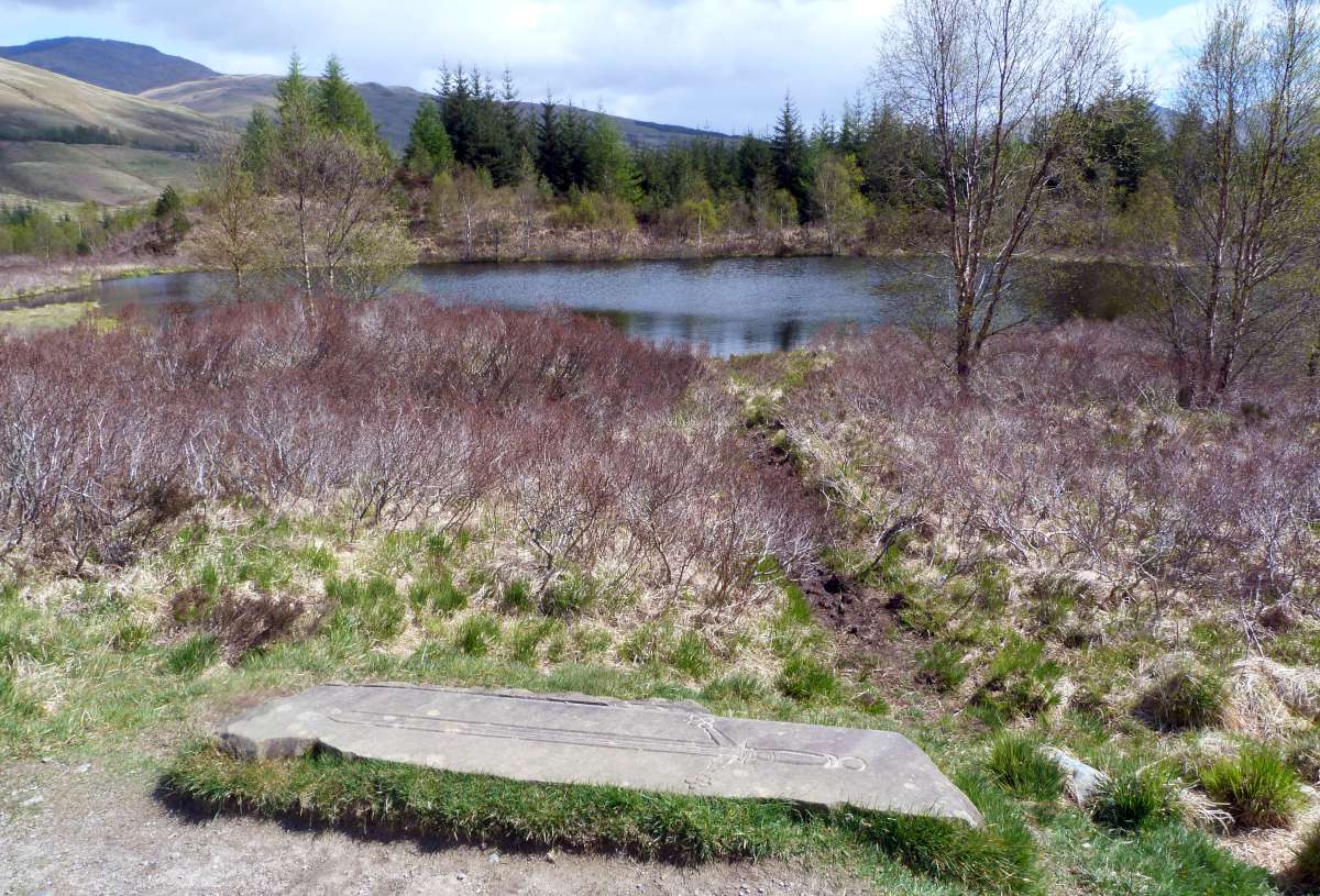
As we pass through Mugdock Wood we see the first sign post for Fort William – already a bit closer than I thought it might be. The first 8 miles have flown by – these five days will be a doddle, surely?! The Beech Tree Inn would be very tempting any later in the day, but the frothing sewage works reminding us the civilisation is not far behind are not so enticing.
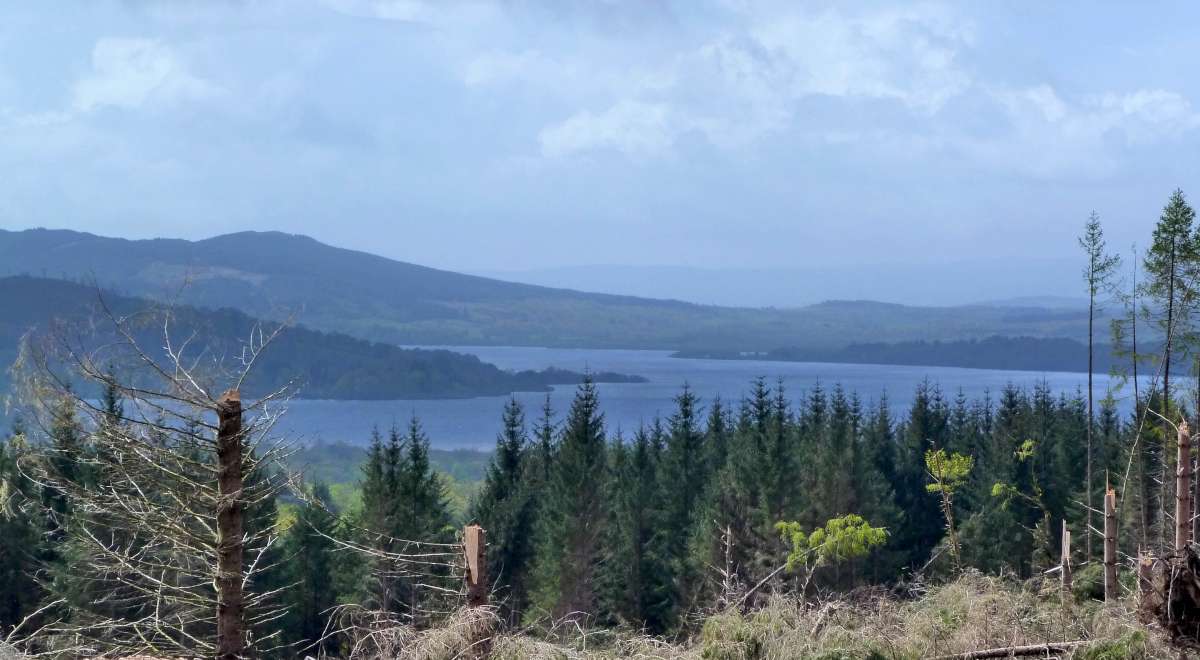 The path climbs and views get nicer and nicer as we approach and pass Upper Gartness. Some recent clearances in the Garadhban Forest give us our first view of Loch Lomond. A loch with which we’ll become very familiar tomorrow!
 Now the showers started, brief and squally, but punctuated by warm sunshine. The kind of weather that plays havoc with waterproofs-decisions! The climb up Conic Hill was steep, and made no more fun by the rain. But once at the top the views down over the Loch were magnificent. As was the generosity of a group of fellows with whom my arrival at the top coincided. While we taking photos, admiring the view and generally catching our breath, one of them got a bottle of whisky out to celebrate the first big hill of the walk. As it well after midday it would have been churlish to refuse their kind offer of malt-refreshments! Sadly I didn’t see them again for the rest of the walk.
 All down-hill now to Balmaha, and worth a quick look back towards Conic Hill and the blue skies.
 Sustenance of ale & haggis were tasty and welcome at the Oak Tree Inn, and their proud boast that the haggis was “locally caught” resulted in very clean plate! Then off to the lovely Passfoot B&B, just a shortish walk up the road from the pub, to be well looked after by Mrs Betty Twaddle. Top
Day 2 – Balmaha to Inveranan, 22½miles.
After a good night’s sleep, a hearty breakfast and much talk from some Americans in the dining room, it was looking to be a fine day over Loch Lomond.
 This view is straight from the B&B. The weather forecast was good, just as well given what a long day it would turn out to be.
 Thankfully I was blissfully ignorant of that at this early time, and the views over Loch Lomond were still looking good. I was expecting a pleasant though fairly uniform loch-side stroll today but it’s very different. The path often veers away from the loch, up hills and down to the shore again, or up into forested sections which almost completely blot out the view. But at least this all makes for a varied day’s walking. Well varied-ish, as if I remember correctly, most of the day is spent in woodland.


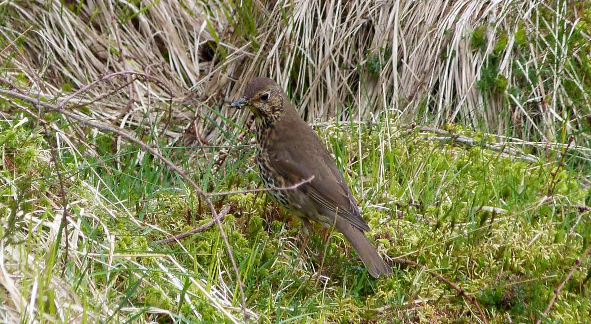
The birds liked the woods though, with this chaffinch and an oyster-catcher milling about in the Rowardennan Forest.


The views over the loch continue to impress – when the breaks in the trees permit.
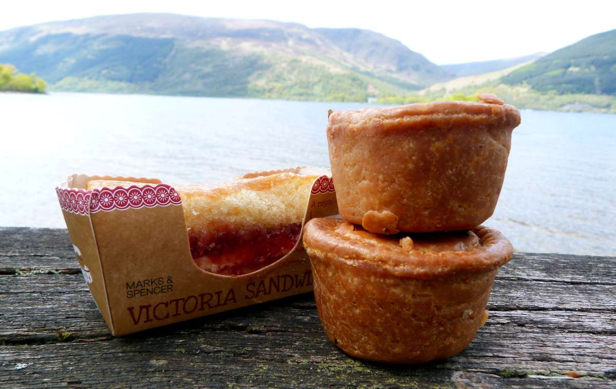

Although the walking was overly tough and the scenery and view were very pleasant, it did still mainly consist of walking in a straight line. And a lot of it is on well made tracks. So not an awful lot of navigating is required – just keep the big wet thing on your left and you’re ok. So things did become a little boring, so I was more thank thankful when I was able to decide it was lunch-time when I found a picturesque resting spot near the Rowardennan Hotel. And as you can see, a fine luncheon it was too!

There is apparently a choice of routes to take here, the low-level loch-side one or one higher-up in the trees. But any tricky decision-making was taken away from me by the low-level one being closed because a fallen tree. So up we went!


Which of course means more ascending and descending, but the upside of ascents are the views – and the fine views continued. Continued on a theme mind you! But that’s not necessarily a bad thing round here.


After the two routes join up again, I completely missed Rob Roy’s cave (I’m pretty sure I don’t have a photo of it anyways). Unless I’m confusing it with one of the other crevices and you have to carefully clamber through – alleviates the boredom if nothing else, but you really do not want to lose your footing on some of these bits. But it’s worth pausing at Bill Lobban’s memorial for a second.


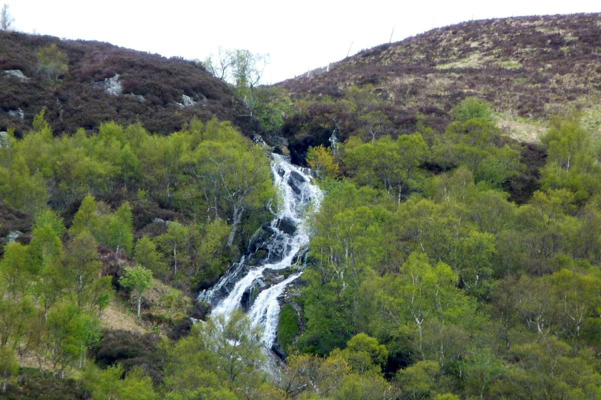
With still much of the Loch yet to go, it’s easy to be come a little used to it. The guide-book mentioned a waterfall by the Inversnaid Hotel that’s worth checking out. You make up own mind from the photo above! And I wish I’d made a note if what this snow-capped mountain was called. I think by now I was just thinking of a beer and a bath! (It’s Ben Lui – thanks Colin!)

But hoorah and hooray! After some 20miles or so we’ve reached the end of the loch at last! At least it makes a nice photo op, despite the idiot spoiling the view.


All that was left today would be a few feral goats, a seemingly long walk down through some woods, finding a water bottle and then shortly afterwards reuniting it with it Policewoman owner. I mananged to catch them up as she was really struggling – and I knew how she felt, past the Beinglas Farm, through a field, over the River Falloch, along the busy A82, a view of the Ben Glas burn coming down Meall Mor nan Eagand, and then at last…


… the Drover’s Inn! And a welcoming party of a house sparrow [ID thanks to Rambling Minster!] as I enjoyed a pint in the last of the day’s sun.

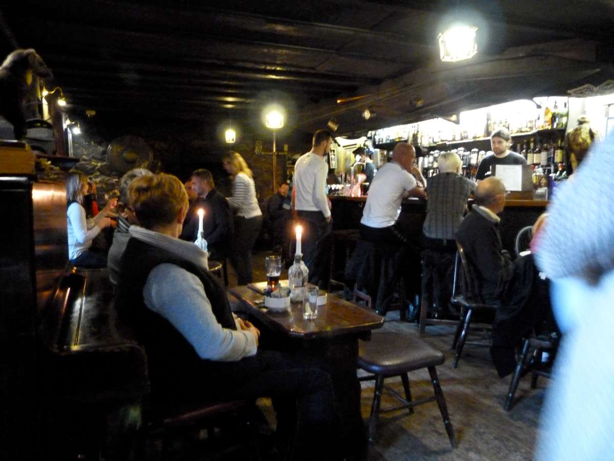
Now, I’d heard a lot about the Drover’s Inn when I was planning the trip – most of it bad. But with bad reviews you often get the picture that the reviewer simply just didn’t like the thing, rather than the thing being bad. And so it is with the Drover’s – I thought it was great. Perhaps a little tatty here & there, but quirky & full of character, warm & welcoming. If you want all your hotels to a Travel Lodge don’t expect to like the Drover’s – but if you want ten ghosts per bedroom do! I even felt a bit sorry for the people who were staying in the modern bit over the road. The beer & evening’s haggis concoction were spot on too. Top
Day 3 – Inverarnan to Bridge of Orchy, 19½miles.
Another fine day up in the Highlands – would my luck with the hold all the way to Fort William I wonder…?
 We head back along the A82 and over the Falloch to Beinglas to rejoin the path to Crianlarich. The views up Glen Falloch are a lovely sight first thing in the morning. Or indeed any time of day I’d say!


The Falloch is a fine companion through the glen and thankfully the A82 and West Highland Line, neither of which are very far away, are both quiet.
 Skirting past Crianlarich we get a nice look up Strath Fillan, and continue along Bogle Glen. Apparently it means “valley of the pixies” but sadly they were not coming out to play today.

I think that’s Ben Challum with a healthy dusting of snow looking down over Inverhaggernie, and I think that’s a song thrush looking up towards it.


After emerging from the woods above Inverherive I stopped for some elevenses under the viaduct over a seemingly nameless burn trickling down to the Fillan. And then after another brief stroll along the A82 we cross over the Fillan heading towards Kirkton Farm and St Fillan’s Priory.

Here we see Annette and Yette, the lovely Dutch mother & daughter team, enjoying views of Fillan flood plain. I’d been walking with them a bit on & off for a last couple of miles, and I think they were stopping for lunch so we said our farewells. Just a little further on is the Lochan of the Legend of the Lost Sword. What do you mean you’ve never heard of it?? Apparently it has something to do with Robert the Bruce fleeing the MacGregors…


I stop for lunch at the comparative bustling metropolis of Tyndrum and its famous Green Welly Stop shop. Well, famous if you saw the same TV programme as I did once. After Tyndrum we continue along side the A82.
 In the shadows of various looming mountains, annoyingly – and again! – I can’t remember the names of any these rocks that I photographed. The above photo is looking back down Strath Fillan from what I remember, before we disappear behind the Mealle Buidhe.


At a crossroads of footpaths where we could if we wanted take a right up to Beinn Odhar, the A82 finally drifts away to the west to leave in peace to march on towards Beinn Dorain – the kilometre high pointy peak in the photo above, and Bridge of Orchy a few miles beyond that. The hard surface of the old military road is getting a bit rough on the feet now.


Just by the Bridge of Orchy railway station I spy a lonely looking caravan. Who’d ever want to stay in that I wondered?? I would, as it would turn out!
 We reach the hotel via an underpass under the railway, and then the bits of pieces of the village that are all dotted along the road down to the hotel.
Despite saying earlier what I did about bad reviews, I am about to give the Bridge of Orchy a bad review! Firstly, having booked in and freshened up with a beer and a shower (not at the same time), they told me they couldn’t fit me in for dinner as they were fully booked. Despite the fact I was staying there. I eventually persuaded them to let me have a bar-snack at the bar, by which time there were plenty of tables available so I was granted one of them. The food itself was very nice though, although I can’t remember what I had – it would have been haggis and something. Then when it came to time to pay (I’d already paid for the bunk-house room, so anything else was extra) there was large queue at the one till. So I wandered off for a couple of minutes across the road to post a post-card. When I returned to pay them I got a right bollocking off some little madam for attempting to do a runner. My protestations that I was staying there didn’t convince them that I wasn’t intending to avoid my £15 bill by running off into the wilds of the Trossachs. So they’d not impressed me already with the service and manners. But then the room we’d been given (not the usual royal we – there was three of us) was tiny. With three tiny beds and not enough room for more than one person not to be in bed at any one time. Nor room for more than one person’s stinky wet walking apparel. And then to make it worse, one chap – a French fellow who was asleep when I got there and was asleep when I left in the morning – snored so loudly that much sleep was not forthcoming. Definitely my least favourite accommodation on this, or perhaps any, walk. Top
Day 4 – Bridge of Orchy to Kinlochleven, 21miles.
Having barely got to sleep, waking up wasn’t difficult. And leaving the Bridge of Orchy Hotel was difficult either, despite the fact the fair weather had finally come to an end. Surely the sun will be shining again by the time we get to Rannoch Moor surely!?


At least the hotel is directly on the path, so we just have to continue where we left off. Immediately crossing over the Orchy over the eponymous bridge. Just after the river we enter some woods and climb upwards – through a soft lazy drizzle. On Mam Carraigh at the top we get our first good views of Rannoch Moor – our companion for the rest of the day.
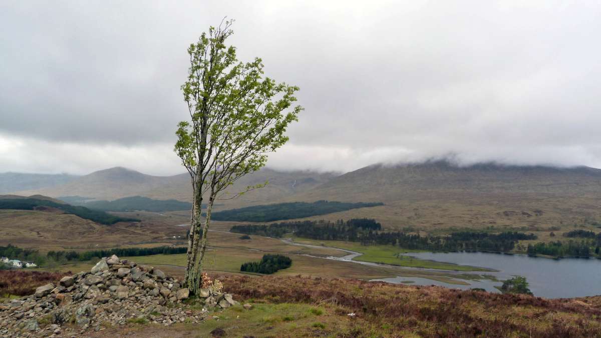

I couldn’t help but be impressed by the hardiness of the this little tree – a birch? – standing up bravely to the elements looking down on Loch Tulla. I wonder how old it really is…? The other pic is I think from low down alongside Loch Tulla looking up to the Black Mount and Rannoch Moor. But I’m not really sure to be honest!
 As we carry on along the well made path, over the Bá gushing through a rocky crevice via Bá Bridge, and then past Bá Cottages, the rainy moors are a lonely place. Well not so much lonely – but a place of solitude. Bá Bridge, my guide tells me, is the remotest spot on the walk. Only the occasional red deer was to be seen – and she had clearly seen me first. No sign of the white hind of local legend though!
As the moor goes on, there’s not an awful lot to see. Especially with this low mist drizzle obscuring any views. We pass the highest point on the path so far – some 1500ft. All downhill from here then! Oh – highest point so far… more uphills to come then!
The guide mentions that we pass Ian Fleming’s brother’s memorial cairn. But I don’t see it. I am briefly distracted by a sign to a chair-lift but I have to keep slogging on.
Past the Black Rock cottage and Buachaille Etive Mor and on to the King’s House Hotel, where more than a few people were staying. Which I thought was rather odd as the day still had a long time to run and Kinlochleven isn’t too far to go. Now they’re all stuck in a place where’s not much to do, and this would then make it a rather long day to Fort William. Who knows?! Indeed, who cares? Although I was briefly envious when I popped in to go to the loo – the lovely warm dry loo…


But I pressed on alongside the River Coupnall as the rain got rainier. It was well after my lunchtime but finding a sheltered spot had been predictably fruitless. So a much-needed rest on the Devil’s Staircase was combined with lunch-time. A father & son passed me, and the father wasn’t having fun at all. All downhill from here I assured him, but as it was to be that wouldn’t have been very reassuring at all.
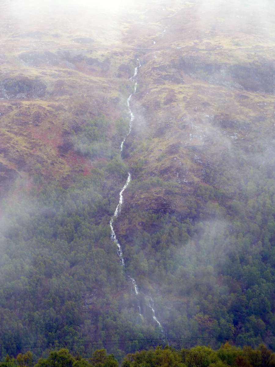 The total climb to the top of the Devil’s Staircase from the Coupnall is a good 800ft, and when we eventually had finished our rainy lunch and got to the top the clouds were beginning to lift. The mist rising from the valley of the Leven was an eerie spectacle.
Now the descent started into Kinlochleven. When you start the final descent of the day after much ascending you can’t help but think to yourself “hooray! easy now all the way to the pub!” but it rarely is. The path down here was long, steep and hard with a lot a sizeable loose rock on the surface. I was fed up with it after not very long.


But there was one brief distraction on the way down. You can’t fail to notice the large water pipes that provide hydro-power for the aluminium plant down in the town. And I noticed that there was the occasional large leak, presumably where a gasket had split. I decided to take a small detour from the downward zig-zags to take a closer look at one these large plumes of water. Which I did for about 1/2 a second, it being exactly that – a large plume of water. Having been under the influence of downwards moving water most of the day it failed to impress me as much as I thought it might. So I turned round to return to the path. And behind me were two pairs of walkers looking at their maps rather puzzledly. “Hmmm” I thought. I bet they’d just blithely followed me assuming that I was going where they were going! Which I suppose I was, but not as directly as they reckoned. But that is an easy mistake to make – as I know only too well!
Anyways, I eventually got to the bottom of the hill by the impressive aluminium plant – which seemed to be still working. Thankfully my B&B “Quiraing” was on this side of town. The landlady was wonderful – it was more a private house than B&B – very homely. And none of this TAKE YER BOOTS OFF! type thing. She just had tramp upstairs muddy and dripping with all my gear to warm up and dry off, but recommending a very pleasant eatery (I had the house special – chicken stuffed with haggis) in town, via a little detour to a nearby waterfall. The one pub in town I tried wasn’t that great, but everything else in Kinlochleven was very nice. Top
Day 5 – Kinlochleven to Fort William, 14miles.
After a perfect night’s sleep I was all ready for the last day – and looking forward to relatively short day, although there’s always mixed emotions about getting to the end of a long walk.


The day started off very grey and the walk out of Kinlochleven was a little damp. Sadly there was no time today to visit the Aluminium Story.


Even the pavement was slippy here – yikes indeed! Although it was reassuring to see a sign-post for our destination. “Lairig” means valley or pass I think, and I can’t recall now whether this is actually the route we took. I’m guessing it must be. With a hindsight though and on a clearer day it might be nice to take a ridge-top route over the Mamores.
 The path climbs steeply providing us with a fine and final view of Kinlochleven.
 Again we’re on the well-made track on the old military way, and despite the low cloud the views over the valley are super. Above is Meall nan Clereach above the Allt na Largie Moire.


But, as is often the way, I can’t remember what all the views are of! The peak above could be Meall a’ Chaorainn… does anyone know?!


Despite the scenery slogging along such a clear track can get a little tedious (relatively tedious!) so the opportunity to cock about in some old ruined crofts is a welcome break! These are at Tigh-na-steubhaich I think.


The path breaks away from the old military road at Blar a’ Chaorainn and heads towards the Nevis Forest. Lochan Lun Da Bhra is near here – apparently the resting place of that old Scottish King MacBeth. But these days it’s probably best not to go too near in case the nasty kelpie that lives there gets you.
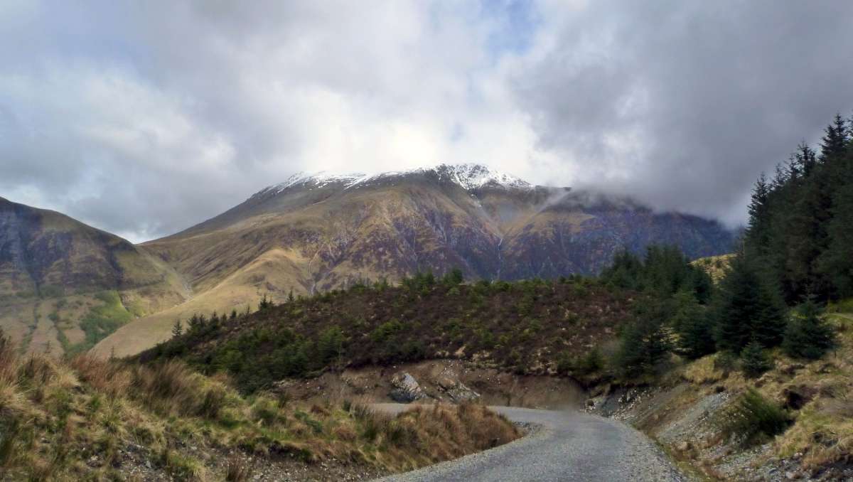 At least I don’t think we’re on the old military road anymore, but it is still very well-kept path. And as we progress through the woods in turns into a road. Easy walking and tough walking at the same time. But it is here that we get our first sighting of the majestic big old Ben Nevis.


And as it’s going nowhere we end up getting constant views of it. And why not? She makes for a fine view.


Having got over my failed rock-hunt I got back to the business of finishing the walk. And the WHW is in the curious position of having two finishes. The original finish comes first, and as I got there I was greeted by a toot from the Jacobite, just leaving for Mallaig. Too bad I didn’t notice the sign inviting me in to claim my certificate. Maybe I was just thinking of the other finish, which half a mile away or so in the town centre.
 Having posed for the obligatory and cliched finished-it-photo I popped in the nearby Ben Nevis pub for a pint of something Orcadian. A few more pubs & pints followed, including some with my policeman/woman friends whom I made friends with at Inverarnan earlier (them of the water bottle.)

Then back to the Cally sleeper to head back down south. The first hour or so of which spent enjoying the view from the back of the train.
What a wonderful part of the world!

snow capped mountain – Ben Lui
Thank you!
well done mate, enjoyed reading your story and glad you enjoyed the drovers, i always base my walk around me staying at the drovers, whw number 12 this year , im off on july 18 th. although i do the way in 7 days, i find the walk so addictive, well done again
Thanks Tom – am tempted to walk it again! Or maybe just a few more nights in the Drovers! :-)
Cheers,
tim