
Knoydart Index.
Day 1 – Glenfinnan to Strathan, 9½ miles.
Day 2 – Strathan to Sourlies, 8 miles.
Day 3 – Sourlies to Inverie, 9½ miles.
******
A Walk to the Pub.

Allt N’ Chaoruinn glen towards Fraoch Bheinn and Sgarr Mhurlagain
Unless you’ve heard of Knoydart it’s very unlikely that you’ve heard of it. I heard about it a few years back when the local community bought the land out-right from private landlords as it made a small splash in the news at the time. (As I was to find out Knoydart is a land full of splashes, small and large!).
I remember hearing things about the area such as “the UK’s last wilderness” and “the most remote pub in mainland Britain”, both of which are rather enticing prospects. You and pretty much imagine what a highlands wilderness would be like, mountains and marshes, monarchs of glens and soaring eagles, and subtle reminders of ancient rebellions and clearances, and such. But I wonder what Britain’s most remote pub is like… could it be a ramshackle old tumble-down crofter’s hut with a little old wizened Caledonian hag of a landlady and a parlour bar, totally bereft of any visitors or would be a trendy gastro-pub with function-room to hire for stag nights and prices that would drive any sensible drinker off to Britain’s 2nd-most remote pub? Actually, I wonder where that is? You must feel sorry for it! Anyways, there’s only one way to find out what it’s like. And that of course is to go there.
There’s two ways of getting to the pub in question, The Old Forge, either get the ferry from Mallaig which involves payment and in these financially straitened times I didn’t fancy that. So the alternative is to walk, which by my reckoning would take three days – but at least is free. (Not counting the rather significant cost of actually getting to the start of course!)
And as they’re going to be on the way why not bag a few Munros along the way? A splendid walk was shaping up.
With valuable pointers from the fine people at The Walking Forum, in particular lasramblas and Highs and Lows, my pub crawl route, taking in four Munros, was going to be thus:
Day 1: Glenfinnan, Strathan, Upper Glendessary.
Day 2: Upper Glendessary, Sgurr nan Coireachan, Garbh Cioch Mor, Sgurr na Ciche, Sourlies.
Day 3: Sourlies, Mam Meadail, Meall Buidhe, Inverie – and the pub!
Another reason for the trip was to try a bit of wild camping, as all the other walks I’ve done have involved B&Bs with cushy mod cons like beds and running water so doing some proper camping for the first time since I was scout might be fun. And now I’ve figured out how to use my GPS properly I also realise that a ‘route’ and a ‘track’ are quite different things! (I must point out though that the GPS was used just for location-clarity and geeky-info like “Ooh 2.3mph – go me!” rather than follow the pointer navigation-for-dummies, not there’s anything wrong with that…) So how did it go? Top
Day 1: Glenfinnan to Strathan, 9½ miles.
I hit my first stumbling block a good few hundred miles short of the start. I had everything carefully planned – the Cally sleeper to Fort William and then hop across the platform to catch the Jacobite to Glenfinnan due to depart 15 minutes later, and should be in Glenfinnan before midday for a reasonable start. But the sleeper was fully booked up for berths, and I didn’t fancy a seat all the way. So I decided to fly to Glasgow, stop overnight and get the first train to FW in the morning – which turned out to the same Cally sleeper train but from Glasgow a seat would be fine, and the rest of the journey could go as planned. As for cost / duration it’s about the same, it’s just the usual faffing around at airports that was the problem. And security of course! Whoops. Having been in train mode I’d packed my bags accordingly only to be reminded at Luton airport check-in that meths wasn’t allowed (once I’d explained to them what meths was… I’m sure aftershave or Ukrainian potato vodka would have been fine but you don’t argue with these people!). So the meths had to be abandoned, not a problem losing £3 worth of fuel but now it meant I’d have to stop off in FW to get some more, I’d miss the Jacobite and have to get the next regular service which wouldn’t get me to Glenfinnan until getting on for 2pm. Bother! But at least the sun was shining.


As I was in no rush in Fort William I watched the Jacobite (hauled by 45407 The Lancashire Fusilier to those interested) pull out and went off to find some meths. And kill three hours in Fort William without going in a pub! Not easy. But finally I got to Glenfinnan and my walk could begin in earnest. I’m not a Believer, but I do believe that old churches are rather nice, so I stuck my head in St Mary & St Finnan’s – the view of Loch Sheil from the door was heavenly indeed.

It’s not long though before we see the first landmark of the walk. The magnificent Glenfinnan viaduct, it really does make a grand sight curving across the glen.


Its greyness is striking – what kind of granite is this I wondered. I hadn’t realised that it’s actually concrete. But as concrete goes I think it fits in pretty well in its surroundings. Them clever Victorians! The only thing that would’ve made this view any better would have been if the Jacobite had come steaming over, but alas that wouldn’t be happening for a few more hours. With a bit more planning that could be worth another trip one day… hmmm…
 Walking up Glenfinnan was very nice indeed, the track was clear and firm – and dry! And the weather was spot-on, plenty of sunshine and a nice breeze. The view down the valley was nice enough to require constant turning round to enjoy it, at which times I thought I might as well take a breather too.

There are a quite a few little footbridges along the way, of varying quality. I reckon this one over the Allt A’ Chaol-Ghlinne was the 2nd most “interesting”. I called it the Irn Bru Bridge – “made in Scotland from girders”! and it bounced and wobbled in a much more alarming way than the old Millennium Bridge ever did. But guessing that its bark was worse than its bite I still managed to do a bit of self-timer posing and not fall in.
Just after the Irn Bru Bridge I greeted a chap sitting outside the Corryhully bothy reading a book in the sunshine. He wasn’t very chatty, and quite why he was settling down for the day at 2pm I don’t know. Anyways, he was to be the last human being I saw until the following night.

The glen got nicer the further I got up, the track became “less and less” but the views continued. It was getting quite steep at parts though, and I was perspiring a little.
 At the top of the glen the Finnan had disappeared in to the marshy bog that is its source, and the breeze at the top was very refreshing as the last bit was a bit of a clamber. Be a conscientious walker I was of course careful to close this gate behind me. As I got over the top the view was splendid.
 Looking down the glen of Allt N’ Chaoruinn towards Fraoch Bheinn and Sgarr Mhurlagain would make for a marvellous spot to stop off for a cup of tea and a biscuit. The blue skies and sunshine were warming – once I’d found a rock to shelter behind from the wind. I took my pack off, and got all the necessary bits and pieces out, stove, cup, teabags, short-bread etc., which were of course at the bottom. But just as the water began to boil the sky darkened and within a minute it the wind was whipping up and the rain was lashing down. Down and horizontally. The hailstones were the size of, well, hailstones but they were fast, cold, hard and plentiful. I quickly got my jacket on, and as usual hopped round briefly like a demented pogo-er trying to get my waterproof trousers on. I got everything packed away pronto (after making sure to make my tea of course – no sudden storm is that bad!) including a still warm stove. Then I really struggled getting the rucksack cover on as my hands were numb from the bashing of the hail. For a little while I just gave up and draped it over the rucksack and crouched down exhausted behind the rock and the weather do its worse to my waterproofs, but then realised that this could be going on the rest of day. So I got the cover on, and hitched the pack on to my back, quickly downed the diluted brew and headed off down the valley. At which point it stopped and literally a minute later it had cleared up, and skies were blue again and a nice jolly rainbow appeared at the bottom of the glen. What a crazy 15 minutes! And what a time to choose for a brew. But at least it’s all gone now, and it’s all downhill from here for the rest of day. Hard stuff done, surely…?
 This photo is looking back up the Allt N’ Chaoruinn with Streap on the left. The terrain down the glen was absolutely terrible – even dangerous, for want of sounding dramatic. Never mind the recent heavy but brief downpour, there must have been a lot of rain recently. The path had disappeared and everywhere was marshy and waterlogged, or very uneven with slippy rocks, watery hollows, ad-hoc rivulets and foot-size hollows disguised by long grass. Walking was incredibly difficult and I must have fallen over at least a dozen times. Mostly on my back, on which thankfully I happened to be carrying a large cushion :-) but on a couple of occasions I fell forwards or sidewards followed by a tumble or two. Quite worrying moments.


It took me getting on for two hours to walk the three or four miles down the glen, although I did pause for a little while to look back at the dear on the slopes of Meall An Fhir-Eoin. I didn’t notice at the time that the stag seemed to be trying to tell me something! Pretty much sums up the whole glen really.


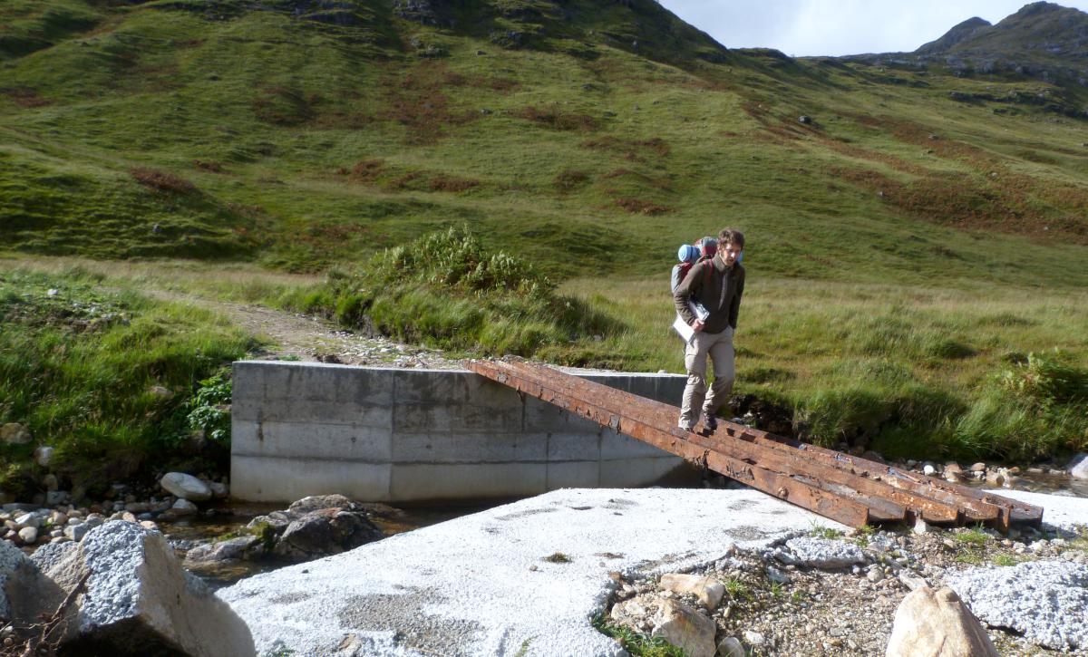
But things weren’t about to get any better just yet. The photo on the left is where the map says “ford”, and on the right is my GPS showing my efforts to find a more realistic fording point. I was pretty sure my feet couldn’t get any wetter but I didn’t really want to try it. The GPS also records my efforts to retrieve a lost hat in the woods!


On reaching the woods I thought there’d be a decent track – and there was. But to get to it (shown in brown on the GPS map above) there was another 100 yards of basically thick dark mud. The first bit of which was the two wheel ruts on the left. One of these contained a sturdy plank to walk along, the other contained 18 inches and gloopy black water. Guess which one I went for first! A similar thing happened twice more until the decent forest track was reached. I was getting a bit fed up by now, and losing my hat was actually a good thing, because finding it again was a bit of morale boost.
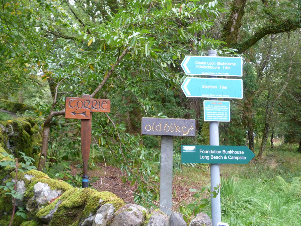
It was starting to get dark now, and up here when it gets dark it gets dark quickly and A’ Chuil bothy was still three miles off. As I didn’t know for sure if there was going to be room there or if it was going to be locked – or even still there! – I figured I’d get my tent up at Strathan as soon as I out of the woods. By the time it was up it was dark, but camping near some woods always means there’s firewood nearby. So the boots were drying and tea was prepared fairly quickly. I was in bed by 9.30pm with only distant honking deer for company, hopefully I’ll be awake by first light – tomorrow could be a long day! Top
Day 2. Strathan to Sourlies, 8 miles.

Morning at Camp Strathan
The previous night I was in bed nice and early, but I was so cold I hardly slept a wink all night. I ended up wearing a shirt, jumper and fleece inside my sleeping bag, plus trousers and socks of course, and a hat, but was still freezing. I’m not sure why – it could be that my new tent wasn’t quite up to it, or it just very cold outside, or perhaps it was the sleeping bag I’d borrowed off my Dad (much less bulky than my own but he knows his outdoor gear) or maybe that I kept sliding off the ground mat didn’t help. I don’t know – probably a combination of all those things. But it meant that I didn’t wake until after 8am, and wasn’t ready to set off until 9.15am. A good couple of hours after I intended. Bother! Oh well, better late than never. At least it looked like a nice day looming. The walk up from Strathan is nice enough along a decent track, and looking back at Streap and Beinne Gharbh and the valley of annoyance – it looks much nicer from a distance!


As I marched along towards Upper Glendessary through light intermittent showers I was still pondering whether I would have time to do the three Munroes which were just to my north, and the fantastic sounding ridge walk. I said to myself that I’d see how I felt when I got there, as that’s when I’d have to turn off towards Sgurr Nan Coireachan, but as I went on I figured I’d be better off getting to Sourlies as early as possible to avoid the rush to pitch up and fire up like last night – I was now slightly envious of the smug chap at Corryhully yesterday enjoying his book his the afternoon sun and pretty soon decided just to plod on and forget the peaks. I managed to justify this to myself by looking at the slight wispy mists up on the tops (above left) – “ooh, could get nasty!” I thought! The view back towards Strathan along Glendessary (right) was nice although this particular stretch of path was again not much fun. Flooded all the way along, and many fords to cross. I’m sure it’s not normally like this, unless in Knoydart a species of grass has evolved to grow underwater! And with thick forest below limiting the views combining with constantly having to think about where to put your feet, and take awkward small steps this stretch was a bit dull.
 I was mightily relieved to get to the top of glen and leave the Dessary behind, and although the top of Garbh Cioch Mor looked fine now I was glad I’d left them alone. It was all (more or less) downhill to Sourlies now, along the Finniskraig river all the way. The valley would make a fine view, if it weren’t for the self-timer’s lack of respect for a nose-wipe! It was very windy here.


The Finniskraig glen was much nicer walking than the Dessary. Above left the river flows in and out of Lochan A’ Mhaim and to the right is another one of those interesting things the OS call ‘fords’! At this one though I struggled to find a point to cross, and after eventually getting about half way across decided that I’d have to take the plunge. It’s only water after all! In the past my waterproof trousers have been prone to blow and flap about a lot in the wind, so prior to setting off I’d made some boot-straps out of old underpant elastic which so far had proved fine except when donning or doffing them! But here the modifications were to prove very handy. As my foot and ankle went clean under I was expecting a boot full of chilly water but with the strap holding my waterproofs in place and the pressure making a good seal, the water was kept firmly out. Excellent. As I looked down in surprise at my submerged but dry (or at least no more wet) foot I thought for a second or two how long I could keep it there, but then quickly thought maybe not and skipped out the river. Maybe these fords aren’t so tricky after all!
 Just past Creag an Fhithich the path rises steeply, tough on the thighs but the view down back up the Finniskraig is well worth it.
 And looking the other way provides the first sight of Loch Nevis, it’s always nice to see your destination – but there again it seems that the closer the destination is the more slowly it approaches!


After dropping back to the river level – 600ft in under half a mile – the footbridge over the Allt Coire Na Ciche was a welcome bit of level terrain, and luckily having to watch my feet enabled to avoid the little amphibious fellow resting in the middle of path.
 The sun and the tide were both out when I got to the eastern end of Loch Nevis. I decided to use the Sourlies Bothy tonight if possible – it can just be seen above the near end of the loch, in front a small clump of trees. I’d decided I didn’t really want to camp again. I was very glad as my hand landed on the latch – but initially dismayed to see it was bolted locked! Just walker’s delirium though – the bolt was on the outside, and presumably there to keep the mice from escaping. (You’ll hear about the mice shortly…) I was glad to be home but too bad the chimney was already belching smoke!
 In the bothy at last and it’s to myself (for the moment) so why not take this opportunity to lark about on the hammock before anyone else turns up??
 Quickly bored with the hammock I figured it was time for a beverage & shortbread before going wood-gathering. Finding a lovely spot for high-tea was not a problem.


At about 250ft above the bothy I’d spotted a likely looking clump of trees, and clambered up there for fire-wood. Fortune was shining on me again as there was a sizeable branch already fallen, and not long after it was dragged down the hill, chopped up and ablaze. Two other lads turned up – Sergei and Tobias from Munich and immediately went off for more wood with typical German efficiency. My timing though was spot on as shortly afterwards it started raining and didn’t let up for the rest of the night. Luckily though we had a splendid bothy fire to settle down to.
 Before the rain though I thought I should toast the Loch Nevis sunset with my last can of Sainsbury’s bitter. I had no beer left now, so getting to the pub was paramount! Although not having to carry a four pack around anymore wasn’t too bad. I dined again on noodles, baked beans with some stir-pasta sauce and parmesan-style-flavoured-powder and it wasn’t not too bad. The Germans were walking the exact opposite to me, and had left Inverie that morning and walked along the shore to get to Sourlies and had gather a bucketful of fresh mussels along the way. They assured me there were very tasty but I declined their offer, as I hate them. Mussels that is, not Germans. Top
Day 3. Sourlies to Inverie, 9½ miles.

Morning above Sourlies
I didn’t sleep well again. I wanted to keep the fire going through the night – there was enough wood for a few more hours, but the Germans didn’t want to. So I was quite cold again, even though I had also had my coat on too along with everything else. But the main problem is that unbelievably this bothy – miles from anywhere – had mice staying there too. And very nocturnally-noisy there were. I heard them in my rubbish bag, alerted by the rattling beer cans, so I put that bag and my food bag on the top bunk. But they were quite active and it sounded like they were wearing hob-nail boots the noise they were making running about. They kept all of us awake, but the Germans came out of worse – the mice had found, unwrapped and eaten pretty much all of Tobias’s big bar of chocolate! Little blighters! Ha ha – maybe a later fire might have kept them at bay…


The next visitors to the bothy would benefit from our wood gathering, and I hope they’d also appreciate my addition to the mantlepiece ornaments, provided to keep a beady-skull-eye open for sweet-toothed rodents.


Off we went our separate and opposite ways, but not quite the exact opposite. The tide was now in so I had to take the high ground to get round the end of the loch. And quite how the path at the top of a steep slope at the top of high ground can be so waterlogged I have no idea. Wait, yes I do – this is Knoydart! Everywhere can be waterlogged if it wants. The two deer are still were watching me ever since my little trip earlier on with a shovel and are probably still wondering what I was doing! The high-level tide-in route was a bit hairy at times, especially in the morning drizzle – one foot wrong I’d be in the loch 50 feet below but there was no real alternative until the tide went out. Once over to the other side and the Carnach flood plain / estuary, call it what you will, and once again quite a bit of time was lost just trying to navigate through the boggy ground. I felt a bit like Frodo and his pals walking through the The Mere of Dead Faces. Thankfully no-one was staring back up at me though… I think.
Yesterday I was really glad I’d decided to miss out the peaks, as I would have really struggled otherwise. The late-start was probably a blessing in disguise. So today I figured I’d do the same and not bother with Meall Buidhe and just make straight for Inverie – and the pub! Always a wise choice I hear you cry.
 But with bridges like this one across the Carnach would I even make it to the pub!?
 Of course I would – there’s clearly nothing wrong with this bridge at all! I was merely clinging to the one supporting cable for effect and didn’t do any self-timer re-enactments because that’s just silly. Honest!


At the Carnoch ruins, with Sgurr na Ciche on the left I think and on the right looking up towards Meille Bhuide. That is going to a steep enough climb even just as far as Mam Meadail.
 The walk up to Mam Meadail was tough but the path was ziggy-zaggy and once up off the valley floor was easy to follow. Naturally the path was also a stream, but I’d come to expect that by now. Again the frequent rests made for good excuses to take in the views of the river Carnach and Carnoch ruins far below. Or should that be vice-versa…?
 This modest little cairn marks the highpoint in the gap between Meall Bhasiter and Sgurr Sgeithe, just over 1800ft. From here I’d be going in the same direction as the streams in the footpaths, back down all the way to sea-level again.
 Just a little further on from the cairn and I got my first view of my final destination – Inverie at the other end of Loch Nevis. And I think Skye further on beyond. I stopped here for lunch, but the 3 day old cheese butty was more functional than satisfying!
I little down the path here I met Rob who was doing a bit of fell running and was staying at the bunkhouse in Inverie, which hadn’t occurred to me before. I was intending to camp again tonight but the bunkhouse was suddenly sounding like a better option. (And as camping was £4 per night, plus £3 to use the showers at the bunkhouse, I figured that the £15 per night for the bunkhouse was probably worth it. They also offer free tea, and there’s plenty of left-over food to choose from. Anyways, the bunkhouse is several miles away yet!)
 Dropping right down now the Brocket Monument stands above the River Inverie with Rum in the distance. Below it is the Allt Gleann Meadail and in the foreground another rickety bridge with bits missing.


After crossing the River Inverie we start the long slog into Inverie itself and tonight’s tea goes past. This could be the chap staring at me whilst answering nature’s call a couple of days ago?
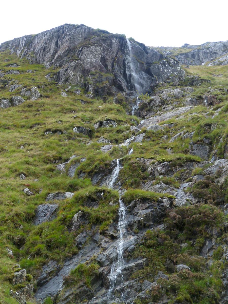
I wondered how the The Allt Dubh could flow from out of the top of the ridge but a glance at the map reveals the Loch Bhraomisaig is up at 1000ft just over the top. It makes for an impressive waterfall.


The track goes on and on. On the left is the Brocket Monument from the other side and the view is back up Gleann Meadail. On the right is what you could call the Inverie suburbs, and to me almost looks a bit Caribbean. Almost! The spits of rain it didn’t feel it though.
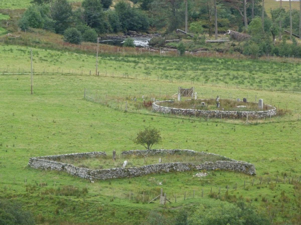
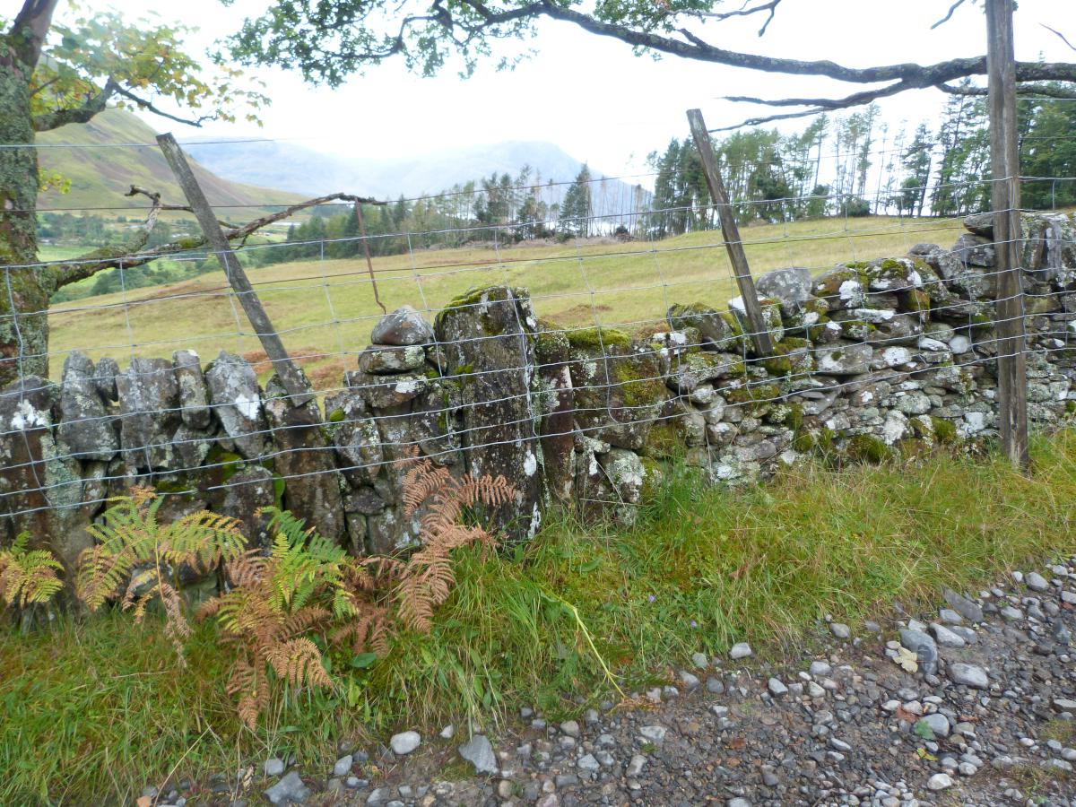
As we get nearer to Inverie the sights become less of-the-wild and more of-the-man, both in life and in death. The graveyards of the Kilchoan Estate are on the left, and an interesting variety of stone wall types on the right. The left section of wall is made up of long tall stones on their ends leaning against each other, like standing dominoes squashed up together. Then on the right is the more traditional type. It kept changing along the track – I’m sure there were good reasons for doing so back then. After the past few days this track was a veritable M1 – TWO Landrovers passed me! Hectic.
 I think we’re definitely on the outskirts of town now, but I can’t believe it’s taken me two days to walk 16miles!! It’s about 14miles as the crow flies, so I’m guessing I was doing a lot of meandering.
I headed off down to the bunkhouse. When I got there there wasn’t a soul about. I sat down for a moment just glad to have reached somewhere! There were some instructions along the lines of “write your name down, choose a bed somewhere, and pay me when you see me. Anna (I’m away stalking).” So that’s what I did. (Well, sort of…!)
After a shower and a nice change of clothes – I hadn’t taken my shirt off in 3 days! – I felt much more presentable. Rob came back in, and I met my room-mate Benny from Belgium. No sign of Anna though – still away with the deer. So I headed off down to the pub – exhibiting post-walk stiffness reminding me that the walking shouldn’t really stop until the walking is over!
 The views in the afternoon sunshine walking through Inverie were beautiful. Above is looking across Loch Nevis at the peaks of north Morar.


Left is looking towards Rum, and on the right the two small monuments are The Bowlby Monument and Our Lady of Loch Nevis.
 The Inverie pottery and tea-room, and Sgurr an Eilein Ghiubhais basks in the last of day’s rays.
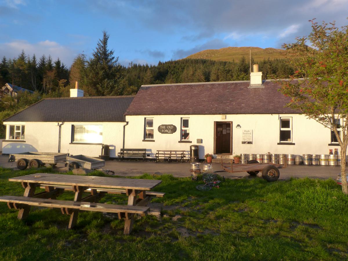 Hoorah – it’s the Old Forge! At last I have reached my destination and the whole point of the walk. I do like a walk that has an ultimate target. Not that there’s anything wrong with a plain old nice walk, but it’s always nicer to feel you’ve reached somewhere or done something. No matter how small there’s always a nice feeling of achievement.
The Old Forge is a fine and lovely pub – thankfully neither of the two things I pondered originally, it’s just a good honest no-nonsense decent boozer. Decent beer, decent food – all decently priced. And very lively. The crowd was mostly tourists and a few locals, but everyone seemed to be getting on famously.
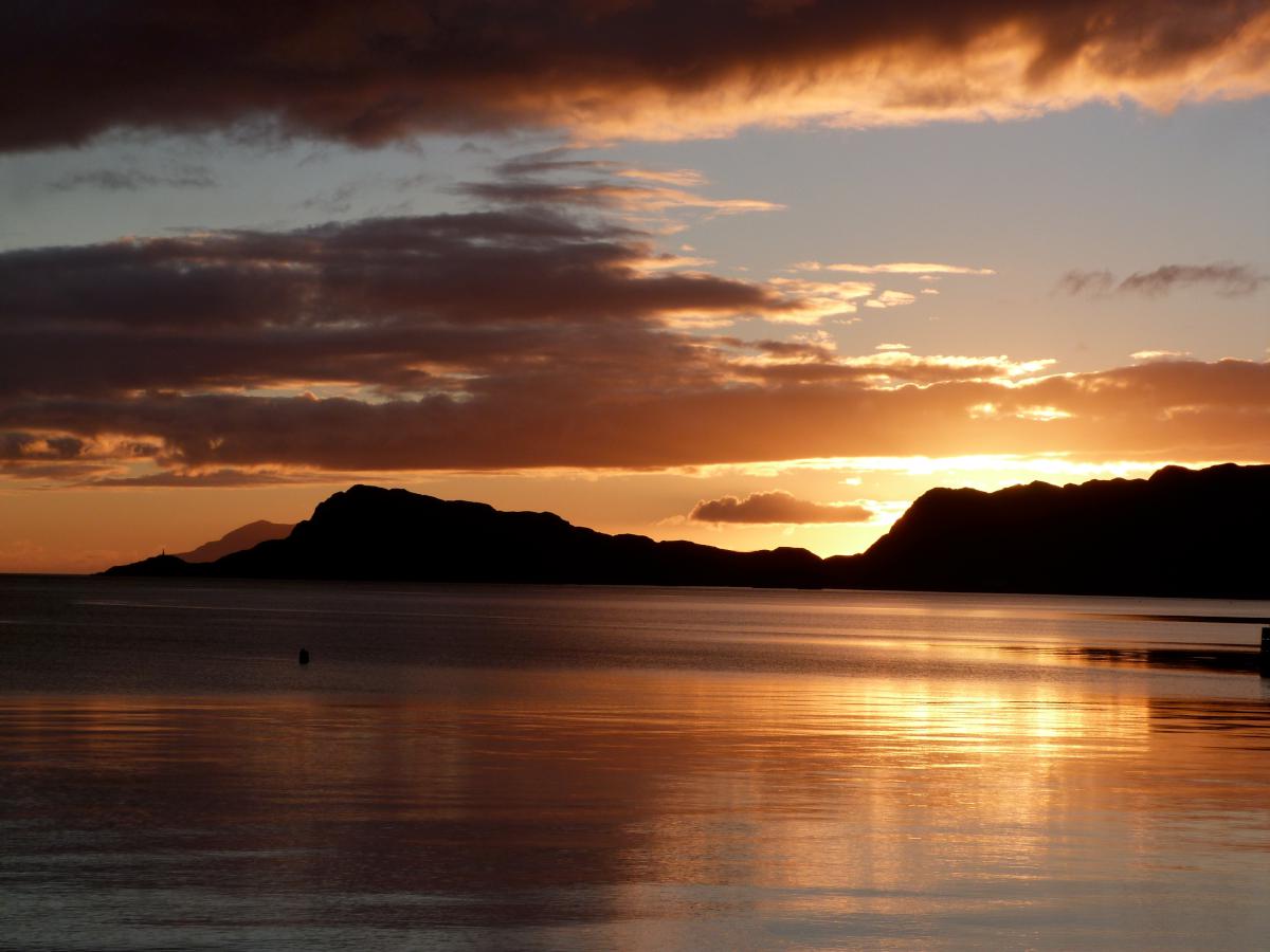 The beautiful sunset helped break the ice as a few us went out cameras at the ready.


And back inside from then on the rest of the evening was spent with fellow bunkers Rob and Benny and one or two others, and two of the barmaids, the lovely Geordie sisters Faye & Susie. A splendid evening was had by all, well by me certainly! (By the way if you happen to stumble across this I looked for you on Facebook but couldn’t find you!)
Susie above is wearing proof the Old Forge’s claim, I like the way it reads like an address. I wonder what the Royal Mail would make of that if I sent them a post-card…? On the right the young lad with his collar up is proudly showing off his freshly blooded face. He received many a congratulatory slap on the back.


The night skies just got better and better. And come going home town the clear skies provided the most amazing display of stars I’d ever seen. Unfortunately the many fine malts that were tasted in the Old Forge seemed to interfere with the focus on the camera! The blame for this lies entirely with those Gateshead girls. So the unfortunately the astro-photos weren’t as good as they might have been. But if you squint you can make out the Milky Way, amongst a billion or two other stars and things. Impressive stuff, even if blurry. Top
Day 4. Homeward bound.
Rum


The next morning was another fine day. On the way out of the bunkhouse I had to take a quick snap of the Morris Traveller in a barn. Every good farm should have a lovely old car in a barn somwhere. Traveller R1266 was lacking an engine though. Breakfast was taken in the Pottery and Tearoom overlooking Loch Nevis and Rum in the distance.

Here comes our taxi home – Bruce Watt’s ferry to Mallaig.
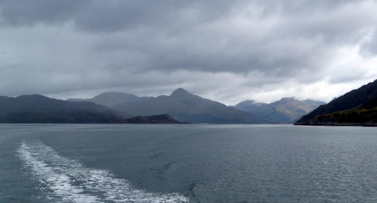
 The valley I’d walked down yesterday slips away into the mist.
 The Bowlby Memorial and Our Lady of the Loch a bit closer up.


Bowlby on the left and Our Lady on the right. There’s more about these peculiar monuments here. It makes interesting reading.
 Can you see the Loch Nevis monster?! Or is just a dolphin?!
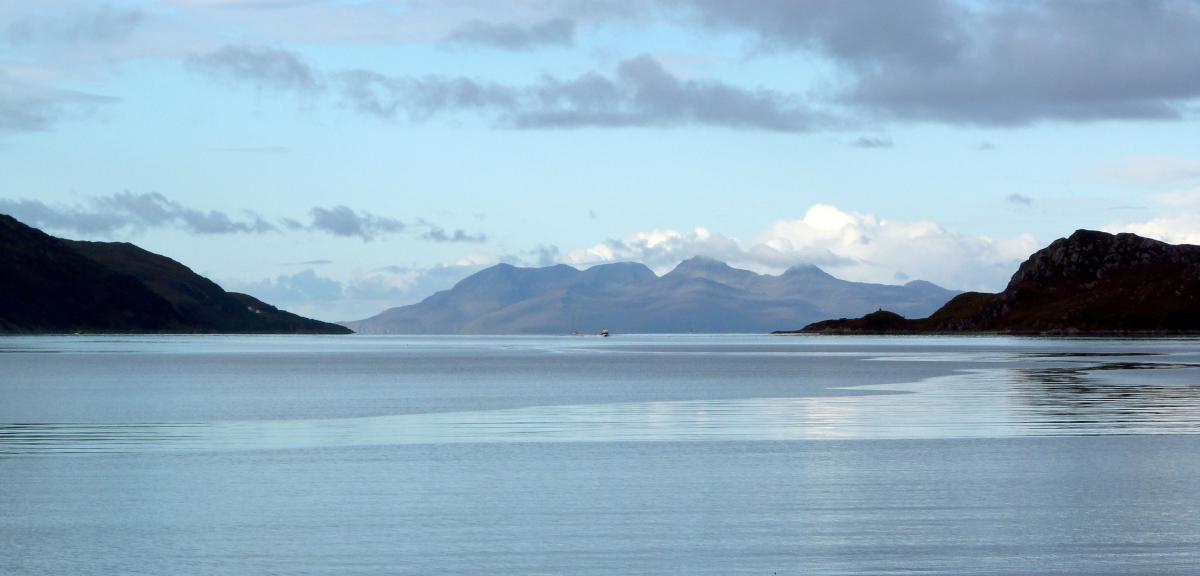
 Eigg and Rum approach.
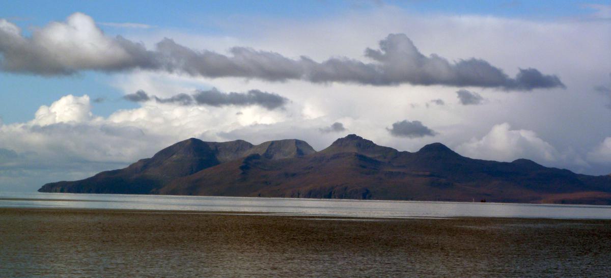
Rum on the left, and on the right the last view of Knoydart as the weather sets in.
 On arrival at Mallaig we’re just in time to see the Jacobite pulls in. Can’t believe it set off before me and I beat it here!


I get the train direct to Glasgow, and the views along the West Highland Line are rightly as well-known as they are. Loch Eilt on the left and looking down on the Callop River on the right.
 Finally we end up where we started, but now on top of the wonderful Glenfinnan viaduct – just as impressive from on it as being under it. And the journey is over. All that was left was to have my breath taken again away by two more beautful visions, once by Kira from Dusseldorf and then again by a jaw-dropping show in the skies above Glasgow. Sadly I’ll never see either of them again!
Knoydart is beautiful, Inverie is friendly and the pub is full of whisky – well worth a three-day walk. I am looking forwards to going back, and this time will try the Munroes again but without the camping gear. Lovely place – but don’t tell anyone!

Left is a plot of a route I ended up going – I need to buy some better maps for my GPS software I think! And the batteries run out just after Carnach, so I’ve filled that in best I can. Therefore I’m not quite sure exactly where I crossed the Inverie (which I could easily find out as it’s where the bridges are!), but it gives you an idea of where I wandering. All the photos I took(616) are available unretouched HERE. Top

Nice read, thanks. I have passed the article on to Fay and Susie.
Tommy (Knoydart Ranger)
Thanks Tommy. I’d better put some nice things in about them then!
See you soon – if can arrange similar weather for around May next year I’d be muchly appreciative :-)
awesome article Tim! Find us on facebook. Fay and Suzie Lambert
Cheers Fay! Will do… I’m sure you said Butler though. Or was my mind just playing word-association tricks on me?!
well done tim..a well written and good photographic editorial of a very pleasant
part of the uk. you should do more of them!!
davethefence
Cheers Dave. It is very pleasant indeed isn’t it? Can’t wait to get back. I was also toying with a Scottish border walk, which would start near you, so I might be coming for a brief visit!
Did you see the Thames Path write-up too? You get a mention…
brilliant
Thanks – you should try it some time. Lovely part of the world!
Excellent walk and review Tim . So good in fact , that I,m completely sold on it , and me and two friends are off on April 25th to follow your entire route
Thanks muchly! Have a great time – look forward to hearing about it! I’m back up there the week after, so I’ll just miss you I think.
Hey David – I just thought, if you don’t want to camp at all there’s another bothy a mile or two from where I camped, which I was pondering using myself, but it was getting dark by the time I got to Strathan so pitched up there. It’s A’Chuil – more details here:
http://www.mountainbothies.org.uk/bothy-details.asp?bothy_id=104
Thanks Tim , its good to know that there,s another bothy nearby if needed . Actually looking forwards to camping though , as we have two good tents between three of us . We,re off up there on Thursday , a 500 mile drive from London , but it,ll be great to get out of the smoke for a few days . I,ll let you know how we get on . Thanks again Tim .
Pingback: A Cheeky Ramble | The Journal of a Geologist
Hi Tim , its five months late but I thought i,d better give my report on our re-tracing your route back in April . Well , it was fantastic , and we thouroughly enjoyed it . Apart from one night of rain when we camped near Strathan , we had unbelievable weather , infact on the days of our hike, it was the hottest part of Britain , with temperatures into the 20,s ! We made one stupid navigational error on day 3 , somehow walking about a mile past the ruins at Carnach without turning to climb , but this was our only blip . Some of the photographs that we took of the sun setting over Inverie were quite something . I wonder Tim , if you had any other suggestions for a similar 3 day walk ? My two friends and I like to go away every April for a two night camping trip , so its about this time of year that I start researching . It doesnt have to be Scotland , anywhere in the UK would be fine . We do like remote though , living in London all year long , walking in a remote area is definitely non negotiable . I,ll hopefully await some ideas from you .
Best regards
David Taylor
Great stuff Dave – glad you enjoyed it and the weather was on your side! A nice walk wouldn’t be a nice walk with the odd navigational blip though! hehe. How is the bridge at Carnach? Would love to see some photos.
As for another suggestion, how about this: https://anicewalk.wordpress.com/2014/05/10/inver-to-inver/ although it’s three nights rather than two.
With a few changes perhaps. I’d suggest walking along the road to Poulary and trying to get past Mam na Seilg before pitching up, the Glengarry Forest was no fun! If I’d have done that I think I probably could have done the whole South Glen Shiel Ridge. You could get a taxi to Poulary or even cut the ridge out all together to shorten it a bit. It certainly is remote! Until you get to Barrisdale that is. And you know you’ve got the Old Forge to look forward to at the end of it. :-)
Blair Athhold to Aviemore